
Ayers Rock
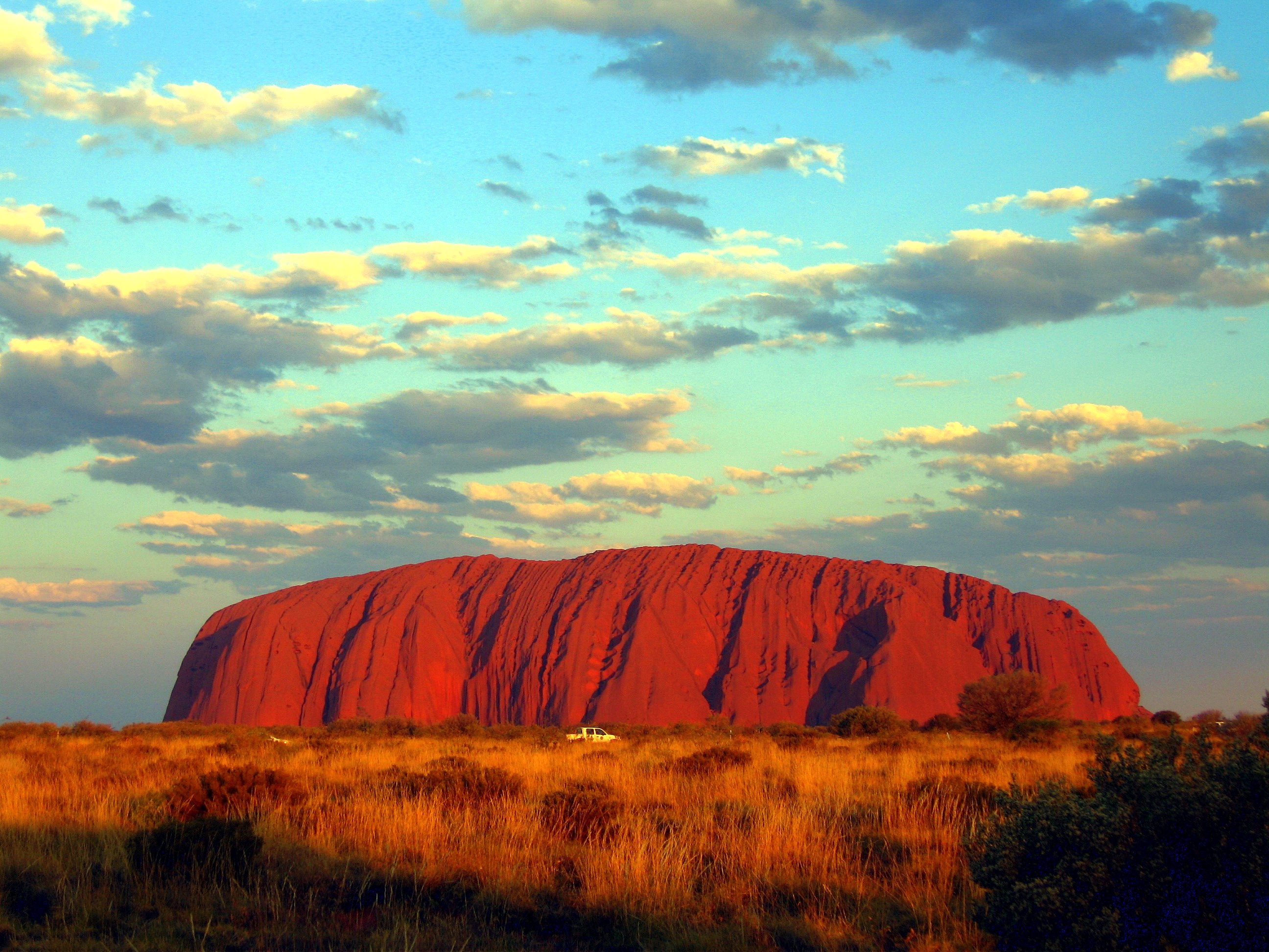
Ayers Rock, a huge natural monolith rising 1,100 feet (335 meters) above the surrounding level desert in the heart of Australia. Known as the Rock to Australians, it is sacred to Aboriginals, who call it Uluru.
Measuring about 1.5 miles by 1 mile (2.5 by 1.5 km), the Rock covers 1,170 acres (468 hectares). Situated in the southwestern corner of the Northern Territory, it can be reached by motor vehicle from Alice Springs in four hours. It is basically red conglomerate stone but appears to change in color according to the time of day.
The Rock was named for Sir Henry Ayers, a 19th-century premier of South Australia. It was included in Uluru National Park in 1950, but its ownership was transferred to local Aboriginals in 1985. The Aboriginals then leased the Rock to the Australian government for 99 years.
Climbing

Climbers and Warning Sign
The local Aṉangu do not climb Uluru because of its great spiritual significance. They request that visitors do not climb the rock, partly due to the path crossing a sacred traditional Dreamtime track, and also due to a sense of responsibility for the safety of visitors. The visitors guide says “the climb is not prohibited, but we prefer that, as a guest on Aṉangu land, you will choose to respect our law and culture by not climbing.”
On 11 December 1983, Australian Prime Minister Bob Hawke promised to hand back the land title to the Aṉangu traditional custodians and caretakers and agreed to the community’s 10-point plan which included forbidding the climbing of Uluru. The government, however, set access to climb Uluru and a 99-year lease, instead of the previously agreed upon 50-year lease, as conditions before the title was officially given back to the Aṉangu.
In 2009, the Australian government indicated that climbing Uluru may no longer be allowed under the proposed “Draft Management Plan 2009–2019”. The public has been invited to comment on the plan prior to submission to the Minister for the Environment.
Several controversial incidents in 2010, including a striptease, golfing, and nudity on top of Uluru, have led to renewed calls for banning the climb.

Sign informing tourists that the climb is closed due to strong wind
Photography
The Aṉangu also request that visitors do not photograph certain sections of Uluru, for reasons related to traditional Tjukurpa beliefs. These areas are the sites of gender-linked rituals, and are forbidden ground for Aṉangu of the opposite sex to those participating in the rituals in question. The photographic restriction is intended to prevent Aṉangu from inadvertently violating this taboo by encountering photographs of the forbidden sites in the outside world.
Map

Map of Uluru (Ayers Rock)

Uluru (Ayers Rock)

Recent Comments